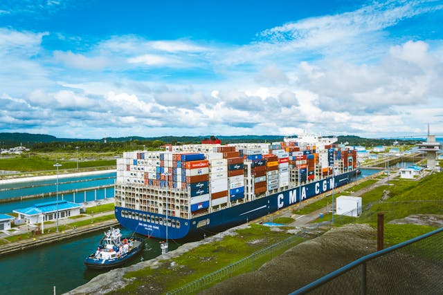
Why are there only the Suez Canal and the Panama Canal? There are only the Suez Canal and the Panama Canal because they are at the two points in the world where shipping distances can be greatly reduced. No other canal would make enough of a difference to be worth the price of building it.
The Suez Canal cuts through Egypt from Port Said to Suez, hence its name. It goes through the narrow part of land that connects the continent of Africa to the continents of Europe and Asia. The strip of land is about 150 km wide and the Suez Canal is 193.3 km long because it doesn’t go in a perfect straight line. The canal allows shipping to go from the Mediterranean Sea in the north to the Red Sea in the South. The Mediterranean Sea is open to the Atlantic Ocean and the Red Sea connects to the Indian Ocean, which connects to the Pacific Ocean. The Suez Canal means ships can get from the Atlantic to the Pacific. Trade between Europe and Asia became exponentially easier thanks to the canal. It was built between 1859 and 1869. Before the canal was built, to get from Europe into Asia, ships would have to sail all around Africa, heading past the infamous Cape of Good Hope. The Cape of Good Hope is not the most southerly point of Africa, but it is the point where ships have to start heading east. The bottom of Africa was a very dangerous place to sail past because a warm water current from the east hits a cold current coming from the north. This produces dangerous waves, winds, and storms. A lot of ships have sunk at this point. The Suez Canal cut 8,900 km and 18 days off the journey from Europe to Asia, but it also made the journey a lot safer. It cost a lot to sail along the canal, but it was worth it to ensure the ship and the goods would arrive. Trying to find another route to India was Columbus’s reason for sailing to the Americas.
The Panama Canal cuts through the thin strip of land that connects South America to North America. It passes through Panama, hence the name, and is 82 km long. There are several natural lakes in the area, which makes the canal much shorter. Sailing along the canal allows ships to pass from the Atlantic to the Pacific and means that ships can easily reach both coasts of the US from Europe and from East Asia. The canal saves ships a journey of 14,818 km because they no longer have to sail around Cape Horn, the southern point of South America. Cape Horn has similar weather to the Cape of Good Hope. Different oceans meet and there are strong winds, huge waves, strong currents, and even icebergs. A lot of ships sank here. The Panama Canal was finished in 1914 and saved ships about 22 days.
So, why are there only these two canals? Are there any other places where a canal would save shipping a lot of time? There are not really any other thin strips of land where a canal could be built. There is a thin strip of land through Turkey that separates the Black Sea from the Mediterranean Sea, but it already has a natural waterway called the Bosporus. There is a canal that goes through Europe from the Black Sea to the North Sea, called the Rhine-Main-Danube Canal, but it is not large enough for big cargo ships and it would probably take ships longer to navigate it than to sail around Europe. The Suez and Panama canals are on thin strips of land that connect two oceans. It made financial sense to cut the canals. There are no other places on Earth that have the same conditions.
They are not canals, but climate change is opening up the Northwest Passage, which will cut a lot of time off journeys. The Northwest Passage goes through the islands that are to the north of Canada and Alaska. It is 1,500 km long. For most of our seafaring history, the Northwest Passage has been completely frozen over and when the ice has melted enough in the summer to get through, there are enormous icebergs that can easily sink ships. However, thanks to climate change, the ice has receded so far that the passage is open for a lot of the year. The route was completely free of ice in 2007, and these days, it is a common route from the Atlantic to the Pacific. The route will make journeys from the east coast of the US to Europe much faster, but at the expense of what? And this is what I learned today.
Try these:
Sources
https://1997-2001.state.gov/regions/wha/panama/991206_faqs.html
https://www.bbc.com/news/business-68467529
https://en.wikipedia.org/wiki/Suez_Canal
https://en.wikipedia.org/wiki/Panama_Canal
https://en.wikipedia.org/wiki/Cape_of_Good_Hope
https://en.wikipedia.org/wiki/Cape_Horn
https://www.history.com/topics/exploration/northwest-passage
Photo by Victor Puente: https://www.pexels.com/photo/cargo-ship-on-docking-area-7629244/
